GRASS GIS, commonly referred to as GRASS (Geographic Resources Analysis Support System), is a free and open source Geographic Information System (GIS) software suite used for geospatial data management and analysis, image processing, graphics and maps production, spatial modeling, and visualization. GRASS GIS is currently used in academic and commercial settings around the world, as well as by many governmental agencies and environmental consulting companies. It is a founding member of the Open Source Geospatial Foundation (OSGeo).
General GRASS GIS Features:
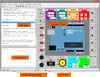
GRASS GIS contains over 350 modules to render maps and images on monitor and paper; manipulate raster, and vector data including vector networks; process multispectral image data; and create, manage, and store spatial data. GRASS GIS offers both an intuitive graphical user interface as well as command line syntax for ease of operations. GRASS GIS can interface with printers, plotters, digitizers, and databases to develop new data as well as manage existing data.
GRASS GIS capabilities:
- Raster analysis: Automatic rasterline and area to vector conversion, Buffering of line structures, Cell and profile dataquery, Colortable modifications, Conversion to vector and point data format, Correlation / covariance analysis, Expert system analysis, Map algebra (map calculator), Interpolation for missing values, Neighbourhood matrix analysis, Raster overlay with or without weight, Reclassification of cell labels, Resampling (resolution), Rescaling of cell values, Statistical cell analysis, Surface generation from vector lines
- 3D-Raster (voxel) analysis: 3D data import and export, 3D masks, 3D map algebra, 3D interpolation (IDW, Regularised Splines with Tension), 3D Visualization (isosurfaces), Interface to Paraview and POVray visualization tools
- Vector analysis: Contour generation from raster surfaces (IDW, Splines algorithm), Conversion to raster and point data format, Digitizing (scanned raster image) with mouse, Reclassification of vector labels, Superpositioning of vector layers
- Point data analysis: Delaunay triangulation, Surface interpolation from spot heights, Thiessen polygons, Topographic analysis (curvature, slope, aspect), LiDAR
- Image processing: Support for aerial and UAV images, satellite data (optical, radar, thermal), Canonical component analysis (CCA), Color composite generation, Edge detection, Frequency filtering (Fourier, convolution matrices), Fourier and inverse fourier transformation, Histogram stretching, IHS transformation to RGB, Image rectification (affine and polynomial transformations on raster and vector targets), Ortho photo rectification, Principal component analysis (PCA), Radiometric corrections (Fourier), Resampling, Resolution enhancement (with RGB/IHS), RGB to IHS transformation, Texture oriented classification (sequential maximum a posteriori classification), Shape detection, Supervised classification (training areas, maximum likelihood classification), Unsupervised classification (minimum distance clustering, maximum likelihood classification)
- DTM-Analysis: Contour generation, Cost / path analysis, Slope / aspect analysis, Surface generation from spot heigths or contours
- Geocoding: Geocoding of raster and vector maps including (LiDAR) point clouds
- Visualization: 3D surfaces with 3D query (NVIZ), Color assignments, Histogram presentation, Map overlay, Point data maps, Raster maps, Vector maps, Zoom / unzoom -function
- Map creation: Image maps, Postscript maps, HTML maps
- SQL-support: Database interfaces (DBF, SQLite, PostgreSQL, mySQL, ODBC)
- Geostatistics: Interface to "R" (a statistical analysis environment), Matlab, ...
- Temporal framework: support for time series analysis to manage, process and analyse (big) spatio-temporal environmental data. It supports querying, map calculation, aggregation, statistics and gap filling for raster, vector and raster3D data. A temporal topology builder is available to build spatio-temporal topology connections between map objects for 1D, 3D and 4D extents.
- Furthermore: Erosion modelling, Landscape structure analysis, Solution transport, Watershed analysis.
Originally developed by the U.S. Army Construction Engineering Research Laboratories (USA-CERL, 1982-1995, see history of GRASS 1.0-4.2 and 5beta), a branch of the US Army Corp of Engineers, as a tool for land management and environmental planning by the military, GRASS GIS has evolved into a powerful utility with a wide range of applications in many different areas of applications and scientific research. GRASS is currently used in academic and commercial settings around the world, as well as many governmental agencies including NASA, NOAA, USDA, DLR, CSIRO, the National Park Service, the U.S. Census Bureau, USGS, and many environmental consulting companies.