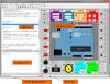
PProtopo allows us to manage the entities "PPoint" and "Contour" and has a nice number of tools, rather than useful for topographic operations with autocad.
Protopo is a surveying program that works under AutoCAD and BricSCAD, developed in Visual .NET with C ++ and C #, with the ARX libraries, (AutoCAD Runtime eXtension) and BRX, (BricsCAD Runtime eXtension), allowing full integration with two CAD systems, which increases the speed and optimization of all drawing and calculation processes.
As a good topography program, it contains tools to import / export all kinds of data, among the different programs and formats available on the market, both observations, coordinates, digital terrain models, longitudinal and transverse profiles, plan layout, type section. , etc.
With the new version 6.1, we have taken a leap in quality, integrating the digital model of the entire earth, every 90 meters, with which you can design any type of project, anywhere in the world, without having to search for elevation information of the study area.
It is a program developed by professionals, surveying engineers and mathematicians, through the experience acquired during years of working in the field as well as collecting the opinions and suggestions that users have given us during these 15 years of Protopo's life. And, for this reason, the program continues to evolve, day by day, to preserve that site that has been won by surveying professionals.
It is a program that covers all the calculation and design needs of a wide range of professionals in surveying, civil engineering and construction
- Field topography: Calculation of radiation, polygonal and coordinates for subsequent representation.
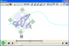
- Geodesy and cartography: Coordinate adjustment between the different reference systems, (Helmert, projective, polynomial, Affine, etc.), as well as, precise calculations of digital models, MDTs, without limit of points, including break lines and, drawing of Smooth contour lines according to different parameters imposed by the user.
- Building: Adjustment and staking out of any type of building work, with very powerful tools that allow exhaustive configuration.
- Reparcelling and calculation of surfaces, in general: Tools for calculating surfaces, as well as a specific one of reparcelling.
- Volume calculation: Different ways of calculating the cut and fill volume of any project (by cross-section, volume between meshes, volume between digital models, MDT), as well as utilities that allow creating projects according to initial needs of the different volumes of cut and fill; volume simulation for decision making.
- Development of construction projects, (Housing developments, roads, conduits, etc.): Very powerful tools to take a project from the original terrain and obtain the final design plan of the work; calculation and drawing of plan axes, gradients, cross-sectional profiles of the project through standard section, slope calculation, volume calculation, etc. Including tools for the subsequent drawing and setting out of the calculated project.
OBSERVATION MANAGER
In a first approach to Protopo we see that it contains a series of tools so that the management of the data taken in the field is fast and efficient.
Thus, it has a first module for the start of a project, with which we carry out the calculation of radiation or observations, to be able to access all our data, (importing them from any electronic notebook or file format, for later easy editing, manual or automatic), in a dynamic way, and perform all the operations that are usually necessary, such as the calculation of traverse, (hanging open, open framed and closed), as well as certain utilities commonly used in surveying, such as calculation of offset points, inverse intersections, (pothenot), etc., that allow us to obtain the coordinates, according to the reference system that we want, (Cartesian, UTM with the ellipsoid of Hayford, UTM with the ellipsoid WGS84, etc),
This module contains the necessary options to be able to maintain a database of instruments, with all their corresponding characteristics, (tolerances, errors, etc.), as well as a highly structured system of files and directories, to allow a management of the works, of independently and orderly, to be able to issue elegant and fast reports.
LONGITUDINAL AND CROSS-CUTTING PROFILES
In a second module, Protopo contains tools for calculating longitudinal and transverse profiles.
An environment, very easy to use, for the introduction of the data that make up the longitudinal profiles, be they "Terrain" or "Project", (flush), being able to import these data from the same CAD or from any standard format on the market, to later edit them.
From this module you can introduce the possible vertical agreements (parables), necessary, on the ground floor, for their development in the project.
And there is also another application, complete, for the management of the cross-sectional profiles that make up a project, be they those collected from the terrain, looking for intersections on the axes in the CAD, or those coming from other standard file formats, as well as those calculated using the type section program.
You can calculate the volume generated by these cross profiles, and also check the data with the drawing of the corresponding areas that make up each of the cut or fill surfaces, in each of the profiles. Very useful if you want to have a thorough check of the data.
TYPE SECTION AND PLANT LAYOUT
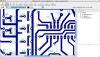
In a third part, Protopo adjusts to the needs of any designer who needs a program for calculating plan axes, be they for roads, conduits or platforms in general, within which he will be able to access the data of that axis from the CAD itself, (and also dynamically edit in CAD), importing polylines or, from any file format used by other programs.
These alignments can include, straight lines, arcs and spirals, (taking into account the current regulations), arranged in the way desired for their calculation; mobile and fixed elements, in very different configurations, to allow the designer to reach the result he is looking for.
In this context of project creation, the program offers the possibility of constructing standard sections, from an environment of easy inclusion of the geometric and topographic elements that compose it; slopes, gutters, berms, driveways, medians, etc, with various options to achieve a complete section of roads, ditches, buildings, etc., very flexible, so that it can be adapted to any type of project.