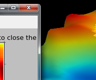
GEOMS2 is a geostatistics and geosciences modeling software. Provides interface for grid (mesh), point, surface and data (non-spatial) objects. It has a 3D viewer and 2D plots using the well known Python engines Mayavi and Matplotlib. It has several functions to manipulate your data as well as provide univariate and multivariate analysis.
NOTE: The software is still an early beta. Please tell us if you found a bug.
Features
- Standalone software but developed with Python and C++
- 2D and 3D engine available (Matplotlib and Mayavi).
- Support for grid (mesh), point data, surface and non-spatial data.
- Tools for multivariate analysis, cluster analysis and spatial manipulation.
- Intuitive interface based on toolbar and mouse context menus.


