Link general
With Edificius-LAND you can address garden design, public and private parks, landscape architecture and exterior spaces design in general, therefore anything connected with urban and public spaces planning.
You have specific BIM objects at your disposal to produce renderings and beautiful project presentations.
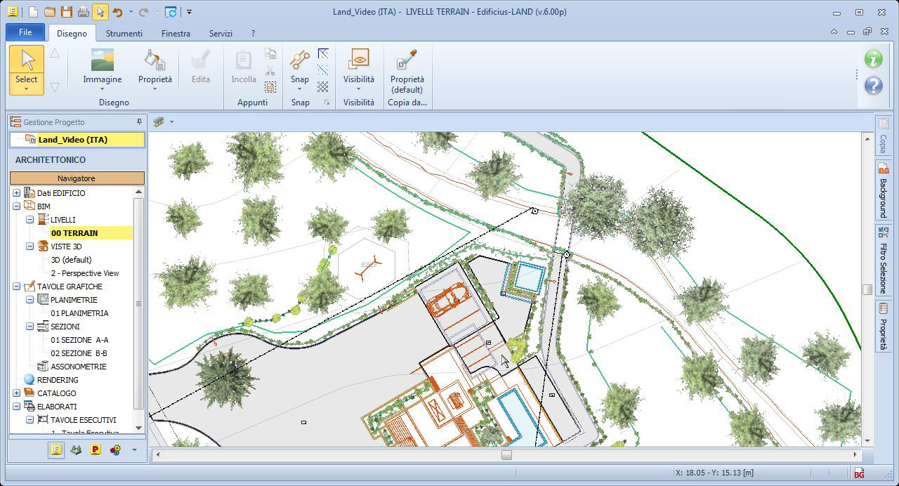
Roads, Yards, Shed structures, Stairs, Ramps… allow you to easily model the necessary objects for garden and exterior spaces design. Landscaping design projects can reach a high level of detail when using advanced parametric objects specifically developed for landscape design such as terrain profile pavements, exterior stair sets and ramps with railings, fences, gratings, gutters, sidewalks and kerbs, barriers, landscaping walls, etc.
Even the flowerbed and swimming pool are at your disposal as parametric BIM objects for modelling.
The Tree object also offers realistic photographic representations of a wide selection of trees, bushes and plants. Edificius LAND already comes with an archive of trees and many others can be downloaded from the continuously updated online catalogue.
Edificius LAND is the BIM software for garden design and landscaping.
The best solution for architects, landscapers and nurseries, companies and professionals who want:
Design exterior spaces perfectly integrated with the architectural design of the building, urban parks, gardens, etc.
Produce detailed plans and high-impact presentations with a powerful Artificial Intelligence (AI) Rendering engine and the most advanced Real Time (RT) and immersive virtual reality (VR) technologies.
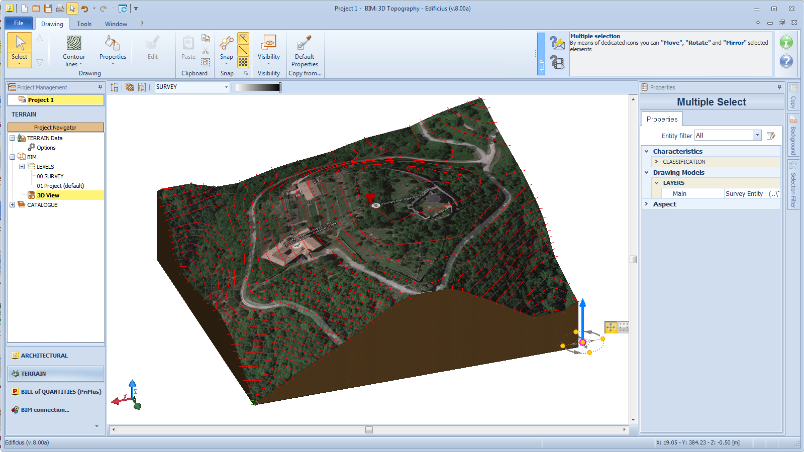
Model the terrain with extreme speed and precision, simulate excavation and fill operations and calculate the volumes of earth moved.
Why choose Edificius LAND to design exteriors and gardens?
- GROUND MODELING
You model the terrain contour lines and dimension plans from topographic surveys in DXF or DWG format or directly from Google Maps®
- 2D / 3D DESIGNS
You have an extensive library of dedicated BIM objects and import of 3D models from SketchUp®, Blender®, Collada®, 3dsMax®, ecc.
- YOU GET PLANS AND PROJECT DOCUMENTATION
You get planimetries, sections, axonometries, legends ... automatically from the 3D model and exportable in DXF and DWG
- YOU GET MEASUREMENTS AND BUDGET
You get the automatic calculation of the moved earth volumes and the project quantities, dynamically updated with each change
- QUALITY RENDER PRODUCTS
Make photorealistic images for captivating presentations, Real-time Rendering and high-impact videos
- NAVIGATE IN THE PROJECT IN IMMERSIVE VIRTUAL REALITY
Live immersive experiences and act in real time on the project with VRiBIM technology integrated in the software
You model the terrain from a DXF / DWG or directly from Google Maps®
Quickly build the digital terrain model from topographic surveys in DXF or DWG format, from cartographies (raster images), or more quickly from Google Maps® satellite photos.
You obtain detailed and professional results in an extremely simple and intuitive way working in 2D or directly in 3D with specific objects that allow the altimetric modeling of the terrain through lines at known elevation (contour lines) or triangulations with vertices at known dimensions (dimensioned plane). ).